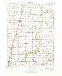
1944 Map of Gilman
USGS Topo · Published 1976About this map
The Illinois Central and Toledo Peoria and Western railroads anchor the development of Iroquois County in the mid-1940s, dictating the growth of town centers like Gilman and Crescent City. This landscape is defined by its methodical grid of rural school districts and family-named crossings, reflecting a densely settled agricultural community. Named schools like Ross Farm Sch, Leggottville Sch, and Vanderpoorten Sch appear at nearly every other section corner, marking the local social hubs of the era.
Find a feature on this map
68 named features on this map. Tap any name to fly to it.
Don’t see what you’re looking for? This feature index may not catch every label — zoom into the map to look around manually.
Map Details
Editions of this 1944 Gilman Map
2 editions found

Other maps of this area

1922 · Momence
USGS Topo · 1:62,500

1922 · Kankakee
USGS Topo · 1:62,500

1923 · Herscher
USGS Topo · 1:62,500

1924 · Momence
USGS Topo · 1:62,500

1924 · Kankakee
USGS Topo · 1:62,500

1925 · Herscher
USGS Topo · 1:62,500

1935 · Watseka
USGS Topo · 1:48,000

1938 · Milford
USGS Topo · 1:48,000

1939 · Watseka
USGS Topo · 1:62,500

1939 · Cissna Park
USGS Topo · 1:62,500