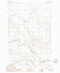
1987 Map of Gilman
USGS Topo · Published 1987About this map
Gilman lies at the heart of this high plains landscape, situated between the rise of Gilman Hill and the winding course of the Sun River. The map captures a moment in the late 1980s where the agricultural and hydraulic infrastructure of the region is clearly visible through the extensive network of the Slope Canal and several head gates. A sense of the area's transportation history is preserved in the Old RR Grade south of the main settlement, tracing a path through the drainage of Elk Slough.
Find a feature on this map
22 named features on this map. Tap any name to fly to it.
Don’t see what you’re looking for? This feature index may not catch every label — zoom into the map to look around manually.
Map Details
Editions of this 1987 Gilman Map
This is the sole edition of this map. No revisions or reprints were ever made.
Other maps of this area

1920 · Choteau
USGS Topo · 1:125,000

1943 · Hogan
USGS Topo · 1:125,000

1955 · Choteau
USGS Topo · 1:250,000

1957 · Choteau
USGS Topo · 1:250,000

1958 · Choteau
USGS Topo · 1:250,000

1960 · Gilman
USGS Topo · 1:62,500
1960 · Freezeout Lake
USGS Topo · 1:62,500

1962 · Choteau
USGS Topo · 1:250,000
1963 · Bowmans Corners NW
USGS Topo · 1:24,000
1963 · Augusta
USGS Topo · 1:24,000