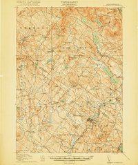
1919 Map of Gilmanton
USGS Topo · Published 1919About this map
Gilmanton Ironworks and the surrounding townships of Belknap and Merrimack Counties represent a landscape of high ridges and established agricultural centers at the end of the first World War. The terrain is defined by prominent elevations such as Catamount Mountain and Cogswell Mountain, which overlook a network of lakes and ponds including Crystal Lake and Shellcamp Pond. The map reveals a dense social infrastructure for a rural area, with numerous named schoolhouses like the Bennett School and Gales School serving dispersed upland communities.
Find a feature on this map
120 named features on this map. Tap any name to fly to it.
Don’t see what you’re looking for? This feature index may not catch every label — zoom into the map to look around manually.
Map Details
Editions of this 1919 Gilmanton Map
2 editions found
Other maps of this area

1909 · Winnepesaukee
USGS Topo · 1:62,500

1917 · Mt. Pawtuckaway
USGS Topo · 1:62,500

1919 · Mt. Pawtuckaway
USGS Topo · 1:62,500

1919 · Gilmanton
USGS Topo · 1:62,500

1919 · Alton
USGS Topo · 1:62,500

1921 · Suncook
USGS Topo · 1:62,500

1925 · Holderness
USGS Topo · 1:62,500

1927 · Concord
USGS Topo · 1:62,500

1927 · Penacook
USGS Topo · 1:62,500

1927 · Gilmanton
USGS Topo · 1:62,500