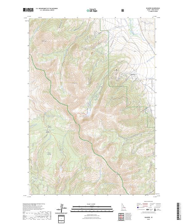
2023 Map of Gilmore
USGS Topo · Published 2023About this map
Gilmore sits at the edge of the high mountain terrain where the Lemhi Range meets the valley floor, serving as the primary human footprint in this high-altitude interior. This 2023 survey by the U.S. Geological Survey details the complex topography of the Salmon National Forest and Challis National Forest, highlighting a landscape defined by dramatic peaks like Negro Peak and Portland Mtn. The settlement’s history is anchored by the Gilmore Cem, while the surrounding wilderness is etched with a network of resource-access routes such as the Silver Moon Gulch RD and the Long Canyon Main RD. Water is scarce but vital, found in high alpine basins like Meadow Lake and Mill Cr Lake. The terrain is deeply fissured by numerous gulches, including Sourdough Gulch, Shorty's Gulch, and Federal Gulch, which suggest a legacy of prospector exploration and seasonal livestock movement throughout the range.
Find a feature on this map
54 named features on this map. Tap any name to fly to it.
Don’t see what you’re looking for? This feature index may not catch every label — zoom into the map to look around manually.
Map Details
Editions of this 2023 Gilmore Map
2 editions found
Other maps of this area

1955 · Dubois
USGS Topo · 1:250,000

1956 · Leadore
USGS Topo · 1:62,500

1956 · Morrison Lake
USGS Topo · 1:62,500

1956 · Nicholia
USGS Topo · 1:62,500

1957 · Gilmore
USGS Topo · 1:62,500

1958 · Dubois
USGS Topo · 1:250,000

1980 · Leadore
USGS Topo · 1:100,000

1987 · Gilmore
USGS Topo · 1:24,000

1987 · Purcell Spring
USGS Topo · 1:24,000
1987 · Gilmore Summit
USGS Topo · 1:24,000