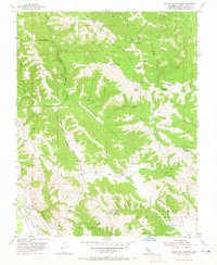
1955 Map of Gilroy Hot Springs
USGS Topo · Published 1965About this map
Gilroy Hot Springs sits at the northern end of this mid-century survey, a notable retreat point in the hills of Santa Clara County. The terrain is defined by the steep drainage of Coyote Creek and high elevations like Palassou Ridge and Wilson Peak. Extensive land grants and ranching history are evident through large named tracts such as Llano Del Tequisquita and Ausaymas Y San Felipe in the southern reaches.
Find a feature on this map
35 named features on this map. Tap any name to fly to it.
Don’t see what you’re looking for? This feature index may not catch every label — zoom into the map to look around manually.
Map Details
Editions of this 1955 Gilroy Hot Springs Map
4 editions found
Other maps of this area

1915 · San Juan Bautista
USGS Topo · 1:48,000

1917 · Morgan Hill
USGS Topo · 1:62,500

1917 · San Juan Bautista
USGS Topo · 1:62,500

1919 · Hollister
USGS Topo · 1:48,000

1921 · Gilroy Hot Springs
USGS Topo · 1:62,500

1921 · Hollister
USGS Topo · 1:62,500

1923 · Hollister
USGS Topo · 1:62,500

1939 · Morgan Hill
USGS Topo · 1:62,500

1939 · Gilroy Hot Springs
USGS Topo · 1:62,500

1939 · San Juan Bautista
USGS Topo · 1:62,500