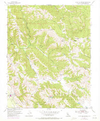
1955 Map of Gilroy Hot Springs
USGS Topo · Published 1972About this map
Gilroy Hot Springs serves as a focal point for this rugged portion of the Santa Clara Valley, where the steep elevations of Palassou Ridge and Phegley Ridge dominate the landscape. The geography is defined by deep drainages like Hagerman Canyon and Coyote Creek, which wind through the complex terrain of the Diablo Range. This 1955 survey, photorevised in the early 1970s, illustrates the land-use patterns of the era, from the established Wilson Ranch to the early development of the Pipeline (Ortega).
Find a feature on this map
39 named features on this map. Tap any name to fly to it.
Don’t see what you’re looking for? This feature index may not catch every label — zoom into the map to look around manually.
Map Details
Editions of this 1955 Gilroy Hot Springs Map
4 editions found
Other maps of this area

1915 · San Juan Bautista
USGS Topo · 1:48,000

1917 · Morgan Hill
USGS Topo · 1:62,500

1917 · San Juan Bautista
USGS Topo · 1:62,500

1919 · Hollister
USGS Topo · 1:48,000

1921 · Gilroy Hot Springs
USGS Topo · 1:62,500

1921 · Hollister
USGS Topo · 1:62,500

1923 · Hollister
USGS Topo · 1:62,500

1939 · Morgan Hill
USGS Topo · 1:62,500

1939 · Gilroy Hot Springs
USGS Topo · 1:62,500

1939 · San Juan Bautista
USGS Topo · 1:62,500