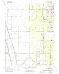
1952 Map of Gilsizer Slough
USGS Topo · Published 1974About this map
Agricultural development in the heart of the Sutter Basin is defined by an extensive network of irrigation canals and drainage systems, most notably the Sutter By-Pass and Tisdale By-Pass. These engineered waterways protect the fertile valley floor while creating a unique environment for the Sutter National Wildlife Refuge along the western boundary. The map captures a transitional landscape where rural education hubs like Lincoln Sch, Barry Union Sch, and Central Gaither Union School anchored the scattered farming communities of Oswald and Barry Substation.
Find a feature on this map
72 named features on this map. Tap any name to fly to it.
Don’t see what you’re looking for? This feature index may not catch every label — zoom into the map to look around manually.
Map Details
Editions of this 1952 Gilsizer Slough Map
3 editions found
Other maps of this area

1888 · Marysville
USGS Topo · 1:125,000

1891 · Marysville
USGS Topo · 1:125,000

1894 · Marysville
USGS Topo · 1:125,000

1895 · Marysville
USGS Topo · 1:125,000

1907 · Dunnigan
USGS Topo · 1:62,500

1910 · Nicolaus
USGS Topo · 1:31,680

1910 · Marcuse
USGS Topo · 1:31,680

1911 · Sutter
USGS Topo · 1:31,680
1911 · Yuba City
USGS Topo · 1:31,680

1911 · Gilsizer Slough
USGS Topo · 1:31,680