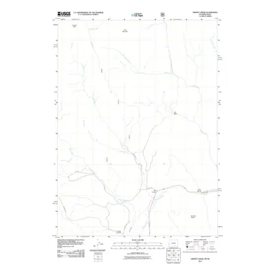
2011 Map of Giraffe Creek
USGS Topo · Published 2011About this map
The Sublette Range and Gannett Hills anchor this 2011 survey of the Wyoming-Idaho borderlands, where the landscape is defined by high-elevation ridges and narrow drainage basins. The map captures a sophisticated network of water management and topography, including the Taylor Canal and Geneva Ditch that skirt the lower slopes. These features, along with the presence of Salt Basin and Salt Canyon, highlight the distinct geological character of this corner of Lincoln County.
Find a feature on this map
29 named features on this map. Tap any name to fly to it.
Don’t see what you’re looking for? This feature index may not catch every label — zoom into the map to look around manually.
Map Details
Editions of this 2011 Giraffe Creek Map
This is the sole edition of this map. No revisions or reprints were ever made.
Other maps of this area

1909 · Montpelier
USGS Topo · 1:125,000

1911 · Montpelier
USGS Topo · 1:125,000

1915 · Crow Creek
USGS Topo · 1:62,500

1921 · Afton
USGS Topo · 1:125,000

1936 · Cokeville
USGS Topo · 1:96,000

1942 · Cokeville
USGS Topo · 1:125,000

1949 · Snowdrift Mountain
USGS Topo · 1:24,000
1951 · Snowdrift Mountain
USGS Topo · 1:24,000

1955 · Preston
USGS Topo · 1:250,000

1958 · Preston
USGS Topo · 1:250,000