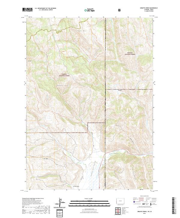
2021 Map of Giraffe Creek
USGS Topo · Published 2021About this map
The Caribou National Forest and Bridger National Forest converge at the Idaho-Wyoming border in this recent survey, marking a high-elevation landscape defined by the Preuss Range and the Gannett Hills. The map traces the rugged divide where water drains into both the Thomas Fork Valley and various high basins. The hydrology is dominated by ephemeral and perennial flows like Giraffe Cr and Preuss Cr, which carve through the Sublette Range in the southeast. A notable topographic transition occurs between the open Salt Basin and the constricted Salt Canyon, illustrating the complex geological folding of the region. Aside from the North Loop road, the area remains largely undeveloped, preserving the wild character of the state line wilderness.
Find a feature on this map
27 named features on this map. Tap any name to fly to it.
Don’t see what you’re looking for? This feature index may not catch every label — zoom into the map to look around manually.
Map Details
Editions of this 2021 Giraffe Creek Map
This is the sole edition of this map. No revisions or reprints were ever made.
Other maps of this area

1909 · Montpelier
USGS Topo · 1:125,000

1911 · Montpelier
USGS Topo · 1:125,000

1915 · Crow Creek
USGS Topo · 1:62,500

1921 · Afton
USGS Topo · 1:125,000

1936 · Cokeville
USGS Topo · 1:96,000

1942 · Cokeville
USGS Topo · 1:125,000

1949 · Snowdrift Mountain
USGS Topo · 1:24,000
1951 · Snowdrift Mountain
USGS Topo · 1:24,000

1955 · Preston
USGS Topo · 1:250,000

1958 · Preston
USGS Topo · 1:250,000