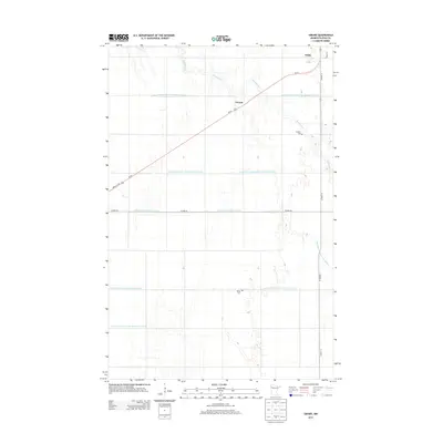
2013 Map of Girard
USGS Topo · Published 2013About this map
The agricultural landscape of Polk County is defined here by an extensive network of water management, illustrated by numerous engineered channels such as County Ditch Number One Hundred Twelve and County Ditch Number Nintyfour. These waterways crisscross the flat terrain of the Red River Valley, supporting the region's intensive farming. Small rural clusters and transportation corridors anchor the local geography, with Us-75 cutting diagonally across the sheet through the settlement of Girard. The map captures essential landmarks for genealogical research, including the Andover Cem located near the meandering path of Burnham Cr, and Hanna Cem situated further south. To the north, the small community of Wilds sits along the roadway, providing a clear picture of the sparse but deliberate settlement pattern characteristic of this northern Minnesota prairie during the early 21st century.
Find a feature on this map
17 named features on this map. Tap any name to fly to it.
Don’t see what you’re looking for? This feature index may not catch every label — zoom into the map to look around manually.
Map Details
Editions of this 2013 Girard Map
This is the sole edition of this map. No revisions or reprints were ever made.
Other maps of this area

1919 · Eldred
USGS Topo · 1:62,500

1919 · Beltrami
USGS Topo · 1:62,500

1952 · Grand Forks
USGS Topo · 1:250,000

1953 · Crookston
USGS Topo · 1:62,500

1956 · Grand Forks
USGS Topo · 1:250,000

1964 · Beltrami
USGS Topo · 1:24,000

1964 · Beltrami SW
USGS Topo · 1:24,000

1964 · Girard
USGS Topo · 1:24,000

1964 · Greenview
USGS Topo · 1:24,000
1964 · Climax
USGS Topo · 1:24,000