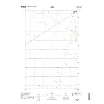
2019 Map of Girard
USGS Topo · Published 2019About this map
Burnham Cr meanders through the heart of the Red River Valley, defining the low-lying topography of this Polk County agricultural landscape. The settlement of Girard and the community at Wilds are situated along a primary transportation corridor that cuts diagonally across the northern portion of the map. This modern survey illustrates the intensive engineering of the local hydrology, as evidenced by an extensive network of drainage systems including County Ditch Number One Hundred Twelve and County Ditch Number Ninety-four. These watercourses reveal the long-term transformation of the Red River Valley into highly productive farmland. For those researching family history in the area, the map precisely locates Andover Cem and Hanna Cem, serving as important markers of the region's rural social structure and early pioneer legacy.
Find a feature on this map
27 named features on this map. Tap any name to fly to it.
Don’t see what you’re looking for? This feature index may not catch every label — zoom into the map to look around manually.
Map Details
Editions of this 2019 Girard Map
This is the sole edition of this map. No revisions or reprints were ever made.
Other maps of this area

1919 · Eldred
USGS Topo · 1:62,500

1919 · Beltrami
USGS Topo · 1:62,500

1952 · Grand Forks
USGS Topo · 1:250,000

1953 · Crookston
USGS Topo · 1:62,500

1956 · Grand Forks
USGS Topo · 1:250,000

1964 · Beltrami
USGS Topo · 1:24,000

1964 · Beltrami SW
USGS Topo · 1:24,000

1964 · Girard
USGS Topo · 1:24,000

1964 · Greenview
USGS Topo · 1:24,000
1964 · Climax
USGS Topo · 1:24,000