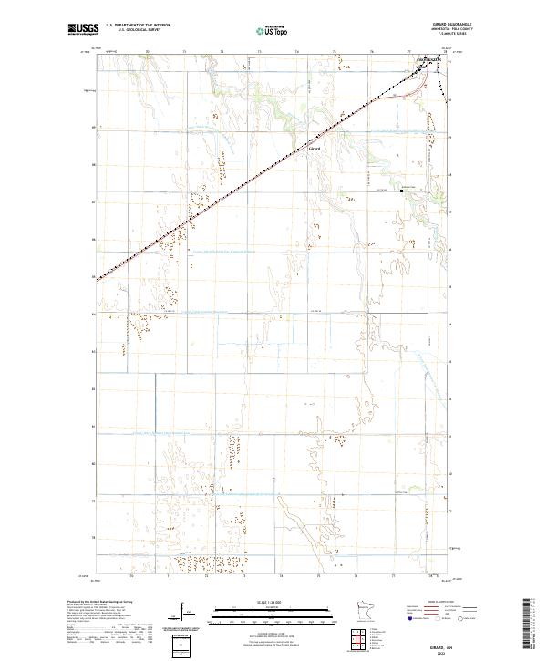
2022 Map of Girard
USGS Topo · Published 2022About this map
Burnham Cr winds through this agricultural landscape in Polk County, where the natural drainage of the Red River Valley is heavily supplemented by an extensive network of man-made channels. The map document's infrastructure, defined by precisely numbered waterways like County Ditch Number One Hundred Twelve and County Ditch Number Ninetyfour, illustrates the intensive land management required for large-scale prairie farming. Small rural clusters and burial sites provide a window into the local genealogy of the area. The settlement of Wilds sits in the northern reaches, while Girard occupies a central position along the section lines. Near the eastern boundary, Andover Cem serves as a localized landmark within a grid of county roads including Co HWY 45 and 280 TH Ave SW.
Find a feature on this map
23 named features on this map. Tap any name to fly to it.
Don’t see what you’re looking for? This feature index may not catch every label — zoom into the map to look around manually.
Map Details
Editions of this 2022 Girard Map
This is the sole edition of this map. No revisions or reprints were ever made.
Other maps of this area

1919 · Eldred
USGS Topo · 1:62,500

1919 · Beltrami
USGS Topo · 1:62,500

1952 · Grand Forks
USGS Topo · 1:250,000

1953 · Crookston
USGS Topo · 1:62,500

1956 · Grand Forks
USGS Topo · 1:250,000

1964 · Beltrami
USGS Topo · 1:24,000

1964 · Beltrami SW
USGS Topo · 1:24,000

1964 · Girard
USGS Topo · 1:24,000

1964 · Greenview
USGS Topo · 1:24,000
1964 · Climax
USGS Topo · 1:24,000