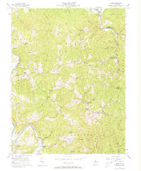
1957 Map of Girta
USGS Topo · Published 1973About this map
Oil Wells and drilling sites pepper the hillsides of Wirt and Ritchie counties in the late 1950s, particularly within the historic Burning Springs oil field. The landscape is defined by a dense network of ridges and hollows, where local life centers on crossroads like Girta and riverbank settlements such as Enterprise and Cherry. This survey highlights a rural infrastructure of one-room schoolhouses and country churches, including the Rising Sun Sch and Wesleyan Chapel, many tucked away on secondary roads and trails.
Find a feature on this map
74 named features on this map. Tap any name to fly to it.
Don’t see what you’re looking for? This feature index may not catch every label — zoom into the map to look around manually.
Map Details
Editions of this 1957 Girta Map
4 editions found
Other maps of this area

1906 · Elizabeth
USGS Topo · 1:62,500

1907 · Harrisville
USGS Topo · 1:62,500

1907 · Arnoldsburg
USGS Topo · 1:62,500

1907 · Spencer
USGS Topo · 1:62,500

1924 · Harrisville
USGS Topo · 1:62,500

1924 · Elizabeth
USGS Topo · 1:62,500

1925 · Arnoldsburg
USGS Topo · 1:62,500

1926 · Elizabeth
USGS Topo · 1:62,500

1926 · Harrisville
USGS Topo · 1:62,500

1927 · Arnoldsburg
USGS Topo · 1:62,500