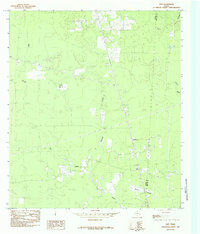
1984 Map of Gist
USGS Topo · Published 1985About this map
High Prairie and Myrtle Prairie anchor this landscape along the border of Jasper and Newton counties in the mid-1970s. The terrain is defined by a complex network of wetlands and drainage patterns, including Gum Slough, Myrtle Bayou, and the Stanton Marsh near Shepherds Creek. A distinct old RR grade cuts through the territory, marking a previous era of timber or industrial transport that predates the modern road system.
Find a feature on this map
13 named features on this map. Tap any name to fly to it.
Don’t see what you’re looking for? This feature index may not catch every label — zoom into the map to look around manually.
Map Details
Editions of this 1984 Gist Map
This is the sole edition of this map. No revisions or reprints were ever made.
Other maps of this area

1926 · Lakeview
USGS Topo · 1:24,000

1926 · Texla
USGS Topo · 1:24,000

1926 · Mauriceville
USGS Topo · 1:24,000

1932 · Beaumont
USGS Topo · 1:62,500

1943 · Mauriceville
USGS Topo · 1:24,000

1943 · Texla
USGS Topo · 1:24,000

1952 · Lake Charles
USGS Topo · 1:250,000

1954 · Lake Charles
USGS Topo · 1:250,000

1954 · Beaumont
USGS Topo · 1:250,000

1955 · Silsbee
USGS Topo · 1:62,500