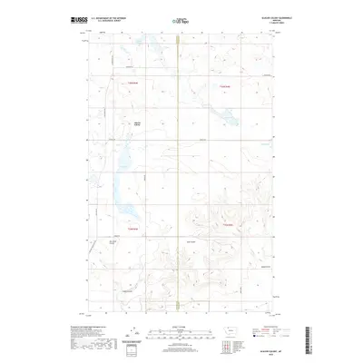
2020 Map of Glacier Colony
USGS Topo · Published 2020About this map
Glacier Colony sits at the heart of this landscape, positioned along the western edge of a significant north-south water system. This modern topographic survey reveals a series of expansive water bodies, including the prominent Hay Lake and the smaller Grassy Lake, which dictate the local terrain and settlement patterns. The map captures the agricultural and communal structure of the area, defined by a sparse but deliberate network of local roads such as Tipville Rd and Berger Rd.
Find a feature on this map
22 named features on this map. Tap any name to fly to it.
Don’t see what you’re looking for? This feature index may not catch every label — zoom into the map to look around manually.
Map Details
Editions of this 2020 Glacier Colony Map
This is the sole edition of this map. No revisions or reprints were ever made.
Other maps of this area

1907 · Blackfoot Res.
USGS Topo · 1:48,000

1909 · Cut Bank
USGS Topo · 1:125,000

1912 · Cut Bank
USGS Topo · 1:125,000

1960 · Cut Bank
USGS Topo · 1:250,000

1963 · Cut Bank
USGS Topo · 1:250,000

1964 · Cut Bank
USGS Topo · 1:250,000

1966 · Ethridge NW
USGS Topo · 1:24,000
1966 · Aloe
USGS Topo · 1:24,000
1966 · Cut Bank
USGS Topo · 1:24,000

1968 · Headlight Butte NE
USGS Topo · 1:24,000