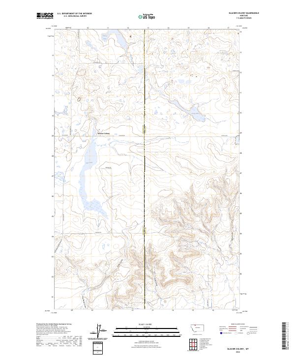
2024 Map of Glacier Colony
USGS Topo · Published 2024About this map
Glacier Colony sits at the center of this high-plains landscape, where the border between Glacier and Toole counties divides a region defined by seasonal water and deep erosional cuts. The northern portion of the map is dominated by a chain of basins including Grassy Lake, Long Lake, and Hay Lake, much of which is preserved within the Glacier County Waterfowl Production Area. This conservation boundary highlights the importance of these prairie potholes to the regional ecosystem.
Find a feature on this map
22 named features on this map. Tap any name to fly to it.
Don’t see what you’re looking for? This feature index may not catch every label — zoom into the map to look around manually.
Map Details
Editions of this 2024 Glacier Colony Map
This is the sole edition of this map. No revisions or reprints were ever made.
Other maps of this area

1907 · Blackfoot Res.
USGS Topo · 1:48,000

1909 · Cut Bank
USGS Topo · 1:125,000

1912 · Cut Bank
USGS Topo · 1:125,000

1960 · Cut Bank
USGS Topo · 1:250,000

1963 · Cut Bank
USGS Topo · 1:250,000

1964 · Cut Bank
USGS Topo · 1:250,000

1966 · Ethridge NW
USGS Topo · 1:24,000
1966 · Aloe
USGS Topo · 1:24,000
1966 · Cut Bank
USGS Topo · 1:24,000

1968 · Headlight Butte NE
USGS Topo · 1:24,000