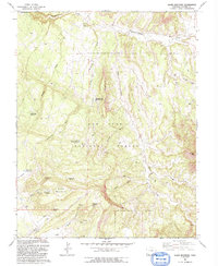
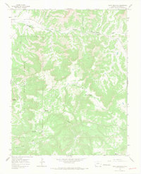
1993 Map of Glade Mountain
USGS Topo · Published 1993About this map
San Juan National Forest encompasses the high-altitude landscape shown here in the 1990s, dominated by the ridge of Glade Mountain. The terrain is defined by a series of long, parallel draws and gulches, including Pine Draw and Willow Draw, which drain toward the north into Disappointment Creek. The area appears managed for water resources and livestock, evidenced by the numerous catchment points such as McKinney Reservoir, Beef Trail Reservoir, and two distinct locations named Disappointment Reservoir No 1.
Find a feature on this map
33 named features on this map. Tap any name to fly to it.
Don’t see what you’re looking for? This feature index may not catch every label — zoom into the map to look around manually.
Map Details
Editions of this 1993 Glade Mountain Map
2 editions found
Other maps of this area

1956 · Cortez
USGS Topo · 1:250,000

1958 · Cortez
USGS Topo · 1:250,000

1959 · Cortez
USGS Topo · 1:250,000

1962 · Cortez
USGS Topo · 1:250,000
1964 · Dawson Draw
USGS Topo · 1:24,000

1964 · Glade Mountain
USGS Topo · 1:24,000
1964 · North Mountain
USGS Topo · 1:24,000

1964 · Mc Kenna Peak
USGS Topo · 1:24,000

1964 · The Glade
USGS Topo · 1:24,000
1964 · South Mountain
USGS Topo · 1:24,000