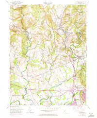
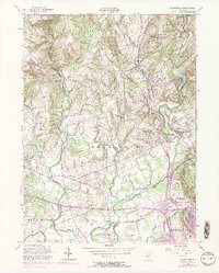
1954 Map of Gladstone
USGS Topo · Published 1973About this map
Hacklebarney State Park and the rugged winding course of the Black River anchor the northern reaches of this New Jersey landscape, where the rural character of Morris and Somerset counties is meticulously documented. The village of Gladstone serves as a focal point for the Erie Lackawanna railroad, which traces the Peapack Brook valley past Peapack and Far Hills. This mid-century survey illustrates a period before significant suburban expansion, highlighting localized institutional development such as St Johns Academy and St Bernards Sch.
Find a feature on this map
73 named features on this map. Tap any name to fly to it.
Don’t see what you’re looking for? This feature index may not catch every label — zoom into the map to look around manually.
Map Details
Editions of this 1954 Gladstone Map
5 editions found
Other maps of this area

1888 · Hackettstown
USGS Topo · 1:62,500

1888 · Lake Hopatcong
USGS Topo · 1:62,500

1890 · High Bridge
USGS Topo · 1:62,500

1891 · Somerville
USGS Topo · 1:62,500

1893 · Somerville
USGS Topo · 1:62,500

1894 · Hackettstown
USGS Topo · 1:62,500

1894 · Lake Hopatcong
USGS Topo · 1:62,500

1898 · Lake Hopatcong
USGS Topo · 1:62,500

1898 · Hackettstown
USGS Topo · 1:62,500

1898 · High Bridge
USGS Topo · 1:62,500
Featured Places
- Bridgewater Township, NJ
- Readington Township, NJ
- Bedminster Township, NJ
- Bernardsville, NJ
- Far Hills, NJ