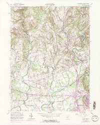
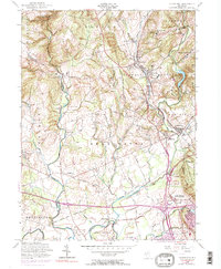
1954 Map of Gladstone
USGS Topo · Published 1973About this map
Washington Camp Ground and the historic crossroads of Pluckemin anchor the southeastern corner of this Somerset County landscape, reflecting the region's deep Revolutionary War ties. The terrain is defined by the steep descent of the Black River through Hacklebarney State Park and the confluence of the Lamington River and North Branch Raritan River. This mid-century survey captures a period of suburban transition, where large estates and institutional grounds like St John Academy and St Bernards Sch sit alongside traditional agricultural fields.
Find a feature on this map
69 named features on this map. Tap any name to fly to it.
Don’t see what you’re looking for? This feature index may not catch every label — zoom into the map to look around manually.
Map Details
Editions of this 1954 Gladstone Map
5 editions found
Other maps of this area

1888 · Hackettstown
USGS Topo · 1:62,500

1888 · Lake Hopatcong
USGS Topo · 1:62,500

1890 · High Bridge
USGS Topo · 1:62,500

1891 · Somerville
USGS Topo · 1:62,500

1893 · Somerville
USGS Topo · 1:62,500

1894 · Hackettstown
USGS Topo · 1:62,500

1894 · Lake Hopatcong
USGS Topo · 1:62,500

1898 · Lake Hopatcong
USGS Topo · 1:62,500

1898 · Hackettstown
USGS Topo · 1:62,500

1898 · High Bridge
USGS Topo · 1:62,500
Featured Places
- Bridgewater Township, NJ
- Readington Township, NJ
- Bedminster Township, NJ
- Bernardsville, NJ
- Far Hills, NJ