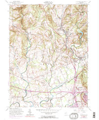
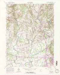
1954 Map of Gladstone
USGS Topo · Published 1973About this map
The Lamington River and North Branch Raritan River carve through this Somerset County landscape, defining the boundaries between Bedminster, Readington, and Branchburg. The 1954 data, updated with 1970s photogrammetric revisions, captures a region of sprawling estates and institutional land use at the edge of the New York metropolitan area's western expansion. Key transport corridors include the Central Railroad of New Jersey and the Erie Lackawanna RR, which served the commuter-focused settlements of Gladstone, Peapack, and Far Hills.
Find a feature on this map
65 named features on this map. Tap any name to fly to it.
Don’t see what you’re looking for? This feature index may not catch every label — zoom into the map to look around manually.
Map Details
Editions of this 1954 Gladstone Map
5 editions found
Other maps of this area

1888 · Hackettstown
USGS Topo · 1:62,500

1888 · Lake Hopatcong
USGS Topo · 1:62,500

1890 · High Bridge
USGS Topo · 1:62,500

1891 · Somerville
USGS Topo · 1:62,500

1893 · Somerville
USGS Topo · 1:62,500

1894 · Hackettstown
USGS Topo · 1:62,500

1894 · Lake Hopatcong
USGS Topo · 1:62,500

1898 · Lake Hopatcong
USGS Topo · 1:62,500

1898 · Hackettstown
USGS Topo · 1:62,500

1898 · High Bridge
USGS Topo · 1:62,500
Featured Places
- Bridgewater Township, NJ
- Readington Township, NJ
- Bedminster Township, NJ
- Bernardsville, NJ
- Far Hills, NJ