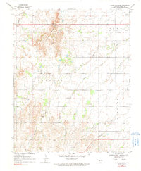
1969 Map of Glass Mountains
USGS Topo · Published 1991About this map
Glass Mountains dominate the landscape in this northwestern Oklahoma region, defined by a series of prominent mesas and escarpments that rise above the surrounding plains. The terrain is deeply carved by a network of drainage systems, including Cheyenne Creek and Cottonwood Creek, which flow through the rugged topography towards the south and east. During this era of the late 1960s, the map records the intersection of geological exploration and rural life, noted by several Drill Holes and gas wells scattered across the prairie.
Find a feature on this map
16 named features on this map. Tap any name to fly to it.
Don’t see what you’re looking for? This feature index may not catch every label — zoom into the map to look around manually.
Map Details
Editions of this 1969 Glass Mountains Map
2 editions found
Other maps of this area

1955 · Woodward
USGS Topo · 1:250,000

1958 · Woodward
USGS Topo · 1:250,000

1969 · Glass Mountains NW
USGS Topo · 1:24,000

1969 · Glass Mountains
USGS Topo · 1:24,000

1969 · Fairview
USGS Topo · 1:24,000

1969 · Cleo Springs
USGS Topo · 1:24,000

1969 · Glass Mountains NE
USGS Topo · 1:24,000

1969 · Glass Mountains SW
USGS Topo · 1:24,000

1972 · Longdale
USGS Topo · 1:24,000

1972 · Canton NW
USGS Topo · 1:24,000