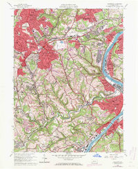
1960 Map of Glassport
USGS Topo · Published 1971About this map
The Monongahela River corridor defines the industrial and residential landscape of this 1960s study, where the steel towns of Glassport, Clairton, and Mc Keesport sit nestled against the water. This period shows the intense industrial footprint of the era, marked by massive slag dumps, slag pits, and a settling basin in West Mifflin. The transition from river-level industry to the suburbanizing uplands is evident in the expanding red-tinted residential areas of Pleasant Hills and Brentwood.
Find a feature on this map
113 named features on this map. Tap any name to fly to it.
Don’t see what you’re looking for? This feature index may not catch every label — zoom into the map to look around manually.
Map Details
Editions of this 1960 Glassport Map
4 editions found
Other maps of this area

1901 · Amity
USGS Topo · 1:62,500

1902 · Brownsville
USGS Topo · 1:62,500

1904 · Amity
USGS Topo · 1:62,500

1904 · Mc Keesport
USGS Topo · 1:62,500

1904 · Carnegie
USGS Topo · 1:62,500

1906 · Brownsville
USGS Topo · 1:62,500

1906 · Carnegie
USGS Topo · 1:62,500

1907 · Pittsburg
USGS Topo · 1:62,500

1908 · Carnegie
USGS Topo · 1:62,500

1931 · Brownsville
USGS Topo · 1:62,500