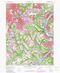
1960 Map of Glassport
USGS Topo · Published 1980About this map
The Monongahela River carves a deep industrial corridor through this landscape, anchoring steel-town centers like Glassport, Clairton, and Dravosburg. By the early 1960s, the plateaus above the river show significant suburban expansion into West Mifflin and Brentwood, while the southern reaches of the map near Gastonville and Finleyville retain a more rural character. This survey highlights the region's diverse economic footprint, from the specialized research at the U S Bureau of Mines Experimental Sta and the logistical hub of the Allegheny County Airport to the numerous mines and slag dumps lining the riverbanks.
Find a feature on this map
87 named features on this map. Tap any name to fly to it.
Don’t see what you’re looking for? This feature index may not catch every label — zoom into the map to look around manually.
Map Details
Editions of this 1960 Glassport Map
4 editions found
Other maps of this area

1901 · Amity
USGS Topo · 1:62,500

1902 · Brownsville
USGS Topo · 1:62,500

1904 · Amity
USGS Topo · 1:62,500

1904 · Mc Keesport
USGS Topo · 1:62,500

1904 · Carnegie
USGS Topo · 1:62,500

1906 · Brownsville
USGS Topo · 1:62,500

1906 · Carnegie
USGS Topo · 1:62,500

1907 · Pittsburg
USGS Topo · 1:62,500

1908 · Carnegie
USGS Topo · 1:62,500

1931 · Brownsville
USGS Topo · 1:62,500