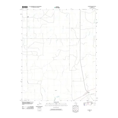
2010 Map of Glazier
USGS Topo · Published 2010About this map
Locust Grove and the small settlement of Glazier anchor this portion of the Texas Panhandle, where the high plains meet a network of seasonal drainages. The landscape is defined by the broad plateau of Big Flat, which is incised by numerous waterways including Clear Creek and the West Fork Clear Creek. The presence of Dry Creek and Little Sand Creek suggests a terrain shaped by intermittent water flow, characteristic of the northeastern corner of the state near the Oklahoma border.
Find a feature on this map
18 named features on this map. Tap any name to fly to it.
Don’t see what you’re looking for? This feature index may not catch every label — zoom into the map to look around manually.
Map Details
Editions of this 2010 Glazier Map
This is the sole edition of this map. No revisions or reprints were ever made.
Other maps of this area

1954 · Perryton
USGS Topo · 1:250,000

1954 · Amarillo
USGS Topo · 1:250,000

1958 · Perryton
USGS Topo · 1:250,000

1958 · Amarillo
USGS Topo · 1:250,000

1972 · Barton Corners
USGS Topo · 1:24,000

1972 · Canadian West
USGS Topo · 1:24,000

1972 · Canadian East
USGS Topo · 1:24,000

1972 · Glazier
USGS Topo · 1:24,000

1972 · Willow Creek
USGS Topo · 1:24,000
1972 · Lake Marvin
USGS Topo · 1:24,000