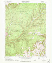
1970 Map of Gleason
USGS Topo · Published 1972About this map
Tioga State Forest dominates this northern Pennsylvania landscape, where the intersections of Ward, Armenia, and Union Townships meet amid high ridges and deep stream hollows. Centered on the small settlement of Gleason, the 1970 survey reveals a rural economy shaped by timber and resource extraction, evidenced by a Strip Mine near Fall Brook and the remote Radio Tower Chamberlain atop the highlands. The rugged topography is carved by numerous waterways, including Sugar Works Run, Rathbone Cr, and the winding Tioga River. Local genealogy and community life are grounded at the southeastern corner of the map, where the North Union Ch and its adjacent North Union Cem stand near the Bradford County line. This era of mapping shows a landscape of recovery, where the State Forest Possessions and established recreational sites like the County Bridge Picnic Area highlight a shift toward public conservation and land management.
Find a feature on this map
33 named features on this map. Tap any name to fly to it.
Don’t see what you’re looking for? This feature index may not catch every label — zoom into the map to look around manually.
Map Details
Editions of this 1970 Gleason Map
4 editions found
Other maps of this area

1900 · Tioga
USGS Topo · 1:62,500

1902 · Tioga
USGS Topo · 1:62,500

1925 · Blossburg
USGS Topo · 1:62,500

1927 · Blossburg
USGS Topo · 1:62,500

1931 · Troy
USGS Topo · 1:48,000

1938 · Troy
USGS Topo · 1:62,500

1942 · Canton
USGS Topo · 1:62,500

1944 · Blossburg
USGS Topo · 1:62,500

1944 · Canton
USGS Topo · 1:62,500

1953 · Roseville
USGS Topo · 1:24,000