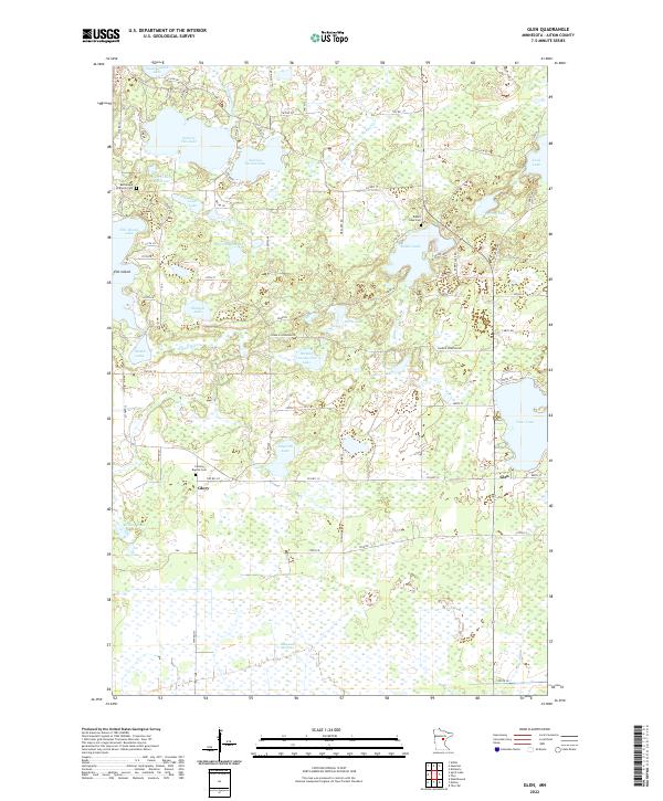
2022 Map of Glen
USGS Topo · Published 2022About this map
Sisabagamah Lake and Section Ten Lake anchor the northern reaches of this Aitkin County landscape, where the terrain is defined by a dense network of glacial water bodies and wetlands. The small settlements of Glen and Glory serve as local crossroads near the center of the sheet, while Elm Island sits to the northwest. This area is notably rich in family and community history, evidenced by Bethlehem Lutheran Cem, Calvary Baptist Cem, and Rabbit Lake Cem. The drainage pattern is led by Rabbit Cr and the Ripple River, flowing through a region where open water often gives way to the marshy expanses of Mille Lacs Meadows. The map reveals a transition from these low-lying wetlands to the larger basins of Clear Lake and Long Lake in the east.
Find a feature on this map
63 named features on this map. Tap any name to fly to it.
Don’t see what you’re looking for? This feature index may not catch every label — zoom into the map to look around manually.
Map Details
Editions of this 2022 Glen Map
This is the sole edition of this map. No revisions or reprints were ever made.
Other maps of this area

1914 · Aitkin
USGS Topo · 1:62,500

1915 · Aitkin
USGS Topo · 1:62,500

1916 · Wealthwood
USGS Topo · 1:62,500

1953 · Duluth
USGS Topo · 1:250,000

1958 · Duluth
USGS Topo · 1:250,000

1969 · Thor SW
USGS Topo · 1:24,000

1969 · Thor
USGS Topo · 1:24,000

1970 · Kimberly
USGS Topo · 1:24,000
1973 · Hassman
USGS Topo · 1:24,000
1973 · Aitkin
USGS Topo · 1:24,000