
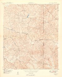
1949 Map of Glen Alta
USGS Topo · Published 1949About this map
Fort Benning Military Reservation dominates this 1940s landscape, with its sweeping boundary line dividing the Georgia countryside. This survey, mapped by the Army Map Service, captures the intricate stream network that feeds into the Ochillee Creek and Holloco Creek watersheds. Small communities and rail stops such as Christopher, Ida Vesper, and Glen Alta appear along the transportation corridors of the Central Georgia and Seaboard routes. The terrain is defined by prominent elevations like Bush Hill and Gobblers Hill, while the Chattahoochee Co Marion Co line marks the political division through the hills. This document illustrates a transition period where civil use and military expansion intersected, preserving the location of unnamed cemeteries and local landmarks like Schley Pond and Gordy Pond before further modernization changed the rural character of this region.
Find a feature on this map
21 named features on this map. Tap any name to fly to it.
Don’t see what you’re looking for? This feature index may not catch every label — zoom into the map to look around manually.
Map Details
Editions of this 1949 Glen Alta Map
2 editions found
Other maps of this area

1908 · Columbus
USGS Topo · 1:62,500

1929 · Columbus
USGS Topo · 1:48,000

1947 · Columbus
USGS Topo · 1:62,500

1949 · Ochillee
USGS Topo · 1:24,000

1949 · Buena Vista NW
USGS Topo · 1:24,000

1949 · Cusseta
USGS Topo · 1:24,000

1950 · Louvale
USGS Topo · 1:24,000

1950 · Buena Vista NE
USGS Topo · 1:24,000

1950 · Buena Vista
USGS Topo · 1:24,000

1950 · Buena Vista
USGS Topo · 1:62,500