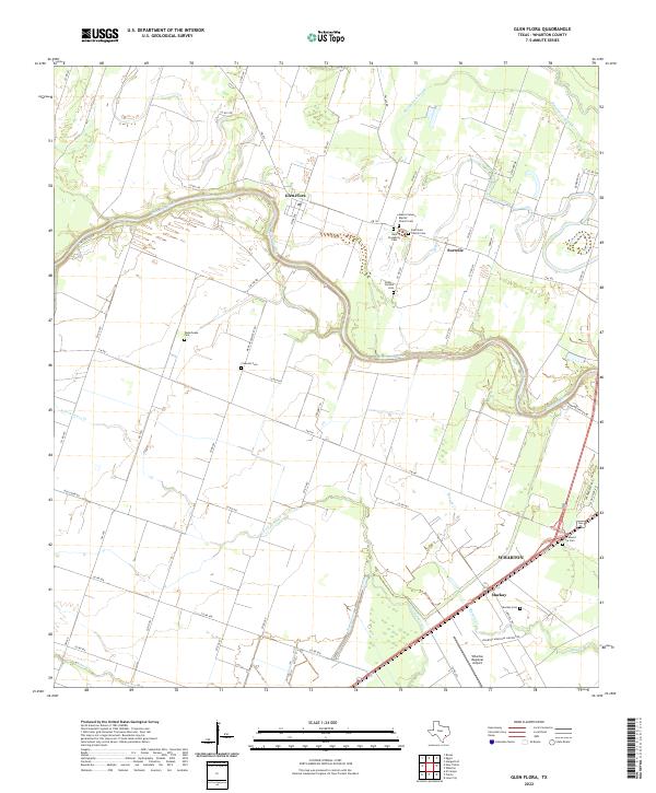
2022 Map of Glen Flora
USGS Topo · Published 2022About this map
Wharton and the nearby agricultural settlements of Glen Flora and Mackay define this landscape along the meandering Colorado River. The area is notably dense with legacy burial grounds, reflecting the diverse community history of Wharton County through sites like the Mexican Cemetery, New Prosperity Cem, and Waterhouse Cem. These landmarks, along with several rural churches, are scattered across a terrain shaped by the river's path and a network of drainage sloughs and creeks including Baughman Slough and Bosque Cr.
Find a feature on this map
60 named features on this map. Tap any name to fly to it.
Don’t see what you’re looking for? This feature index may not catch every label — zoom into the map to look around manually.
Map Details
Editions of this 2022 Glen Flora Map
This is the sole edition of this map. No revisions or reprints were ever made.
Other maps of this area

1952 · Lane City
USGS Topo · 1:24,000

1952 · Pierce
USGS Topo · 1:24,000

1952 · Egypt
USGS Topo · 1:24,000

1953 · Wharton
USGS Topo · 1:24,000

1953 · Hungerford
USGS Topo · 1:24,000

1953 · Glen Flora
USGS Topo · 1:24,000

1953 · Seguin
USGS Topo · 1:250,000

1958 · Seguin
USGS Topo · 1:250,000

1959 · Bonus
USGS Topo · 1:24,000

1960 · New Taiton
USGS Topo · 1:24,000