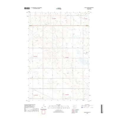
2020 Map of Glen Ullin NW
USGS Topo · Published 2020About this map
Morton Co and Mercer Co meet along a straight east-west boundary line in this high-plains landscape west of Mandan. The terrain is defined by the winding course of Elm Cr in the northeast and a complex network of sections and county roads that follow the Public Land Survey System. In the eastern portion of the map, Saint Clement Cem serves as a localized landmark along Co Rd 140 near Co Hwy 88. The map documents the modern rural infrastructure of the region, where gravel and paved routes like Co Rd 89 and 71st Ave provide access to the rolling cattle country and agricultural fields of western North Dakota. This 2020 edition offers a clear look at the contemporary land divisions and water features before they reach the larger drainage basins to the east.
Find a feature on this map
30 named features on this map. Tap any name to fly to it.
Don’t see what you’re looking for? This feature index may not catch every label — zoom into the map to look around manually.
Map Details
Editions of this 2020 Glen Ullin NW Map
This is the sole edition of this map. No revisions or reprints were ever made.
Other maps of this area

1953 · Dickinson
USGS Topo · 1:250,000

1953 · Watford City
USGS Topo · 1:250,000

1954 · Bismarck
USGS Topo · 1:250,000

1954 · McClusky
USGS Topo · 1:250,000

1957 · Dickinson
USGS Topo · 1:250,000

1957 · Watford City
USGS Topo · 1:250,000

1958 · Bismarck
USGS Topo · 1:250,000

1958 · McClusky
USGS Topo · 1:250,000

1960 · Glen Ullin
USGS Topo · 1:24,000

1967 · Watford City
USGS Topo · 1:250,000