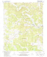
1980 Map of Glenallen
USGS Topo · Published 1980About this map
Glenallen and the surrounding Bollinger County landscape are defined by the winding course of Crooked Creek and its many tributaries, including Gimlet Creek and Limbaugh Branch. In the late 1970s, the area remained a mix of small crossroads settlements and rugged terrain, with Bessville situated to the north. Transportation history is etched into the topography via the Old Railroad Grade and Old RR Gr, marking the paths of former rail lines that once served these timber and farming communities.
Find a feature on this map
34 named features on this map. Tap any name to fly to it.
Don’t see what you’re looking for? This feature index may not catch every label — zoom into the map to look around manually.
Map Details
Editions of this 1980 Glenallen Map
2 editions found
Other maps of this area

1933 · Marble Hill
USGS Topo · 1:62,500

1933 · Marquand
USGS Topo · 1:62,500

1934 · Advance
USGS Topo · 1:62,500

1935 · Zalma
USGS Topo · 1:62,500

1937 · Marble Hill
USGS Topo · 1:62,500

1938 · Marquand
USGS Topo · 1:62,500

1939 · Advance
USGS Topo · 1:62,500

1939 · Zalma
USGS Topo · 1:62,500

1949 · Paducah
USGS Topo · 1:250,000

1949 · Rolla
USGS Topo · 1:250,000