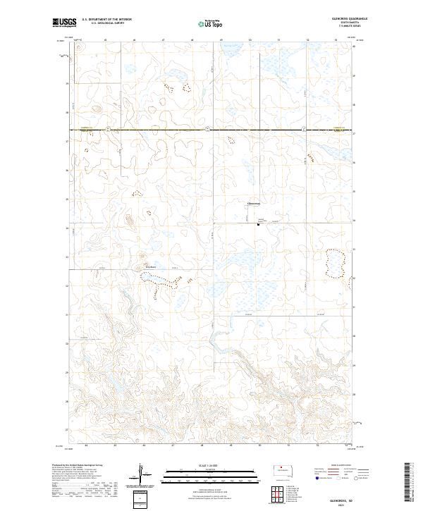
2021 Map of Glencross
USGS Topo · Published 2021About this map
Glencross sits near the heart of this North Central South Dakota landscape, positioned along the border of Corson and Dewey counties. The area is characterized by the expansive prairie topography of the Cheyenne River Indian Reservation, where water features like Spring Lake and the winding course of Dog Butte Creek define the drainage patterns. A significant local landmark, the Sacred Heart Cemetery, serves as a primary point of historical and genealogical interest near the settlement. The survey detail illustrates the intersection of rural life and geography, showing a network of section-line roads including County Road 6 and County Road 8 that navigate around prominent terrain features such as Dog Butte. The map reflects the enduring agricultural and ranching character of the region, captured in its modern configuration while maintaining the original township and range grid system.
Find a feature on this map
25 named features on this map. Tap any name to fly to it.
Don’t see what you’re looking for? This feature index may not catch every label — zoom into the map to look around manually.
Map Details
Editions of this 2021 Glencross Map
This is the sole edition of this map. No revisions or reprints were ever made.
Other maps of this area

1952 · Whitehorse
USGS Topo · 1:24,000

1952 · Glencross SE
USGS Topo · 1:24,000

1953 · McIntosh
USGS Topo · 1:250,000

1956 · Little Eagle SW
USGS Topo · 1:24,000

1956 · Little Eagle SE
USGS Topo · 1:24,000

1956 · Miscol SE
USGS Topo · 1:24,000

1958 · McIntosh
USGS Topo · 1:250,000

1975 · Glencross
USGS Topo · 1:24,000
1975 · Glencross NE
USGS Topo · 1:24,000

1978 · Timber Lake
USGS Topo · 1:24,000