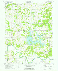
1974 Map of Glendale
USGS Topo · Published 1976About this map
Dogwood Lake serves as the centerpiece for the Glendale State Fish and Wildlife Area, a sprawling aquatic landscape that reshaped the drainage of Mud Creek and Aikman Creek by the early 1970s. The surrounding rural landscape is dotted with small, crossroads settlements including Glendale, Pennyville, and Corning. Local history is deeply etched into the township boundaries of Harrison and Reeve, where numerous family and community burial grounds like East Union Cem and St Patricks-Glencoe Cem remain preserved. To the south, the East Fork White River carves a meandering path through the bottomlands, crossed by the Straight Road Bridge. This survey reflects a mid-century transition where traditional farming communities around Waco and Hudsonville began to interface with expanded state-managed conservation and recreational zones.
Find a feature on this map
58 named features on this map. Tap any name to fly to it.
Don’t see what you’re looking for? This feature index may not catch every label — zoom into the map to look around manually.
Map Details
Editions of this 1974 Glendale Map
2 editions found
Other maps of this area

1902 · Ditney
USGS Topo · 1:125,000

1903 · Velpen
USGS Topo · 1:62,500

1944 · Montgomery
USGS Topo · 1:24,000

1944 · Glendale
USGS Topo · 1:24,000

1944 · Washington
USGS Topo · 1:24,000

1945 · Sandy Hook
USGS Topo · 1:24,000

1946 · Jasper
USGS Topo · 1:24,000

1956 · Alfordsville
USGS Topo · 1:24,000

1956 · Loogootee
USGS Topo · 1:24,000

1956 · Vincennes
USGS Topo · 1:250,000