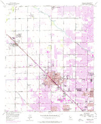
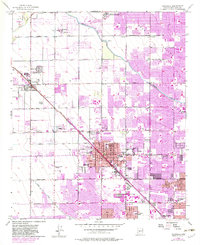
1957 Map of Glendale
USGS Topo · Published 1977About this map
Glendale and Peoria are the primary urban centers in this mid-century view of the Salt River Valley, where agricultural infrastructure and industrial expansion are clearly visible. The Atchison Topeka and Santa Fe railroad corridor serves as the spine of the region, connecting local cotton gins to larger markets. Water management defines the landscape, with the Arizona Canal and Grand Canal cutting through the terrain to support a grid of farm tracts and newer suburban developments. Notable institutional presence includes the American Institute for Foreign Trade and the Southwest Poultry Experiment Station, reflecting the area's transition from purely rural to a diverse economy. Genealogists can find several burial sites including Resthaven Cemetery and the Russian Molokan Cemetery, while early educational landmarks like Glendale School No 1 and Grand Canyon College mark the community's growth.
Find a feature on this map
36 named features on this map. Tap any name to fly to it.
Don’t see what you’re looking for? This feature index may not catch every label — zoom into the map to look around manually.
Map Details
Editions of this 1957 Glendale Map
6 editions found

Other maps of this area

1912 · Phoenix
USGS Topo · 1:62,500

1914 · Phoenix
USGS Topo · 1:62,500

1946 · Avondale
USGS Topo · 1:62,500

1948 · Cashion
USGS Topo · 1:62,500

1952 · Phoenix
USGS Topo · 1:24,000

1952 · Fowler
USGS Topo · 1:24,000

1952 · Phoenix
USGS Topo · 1:62,500

1954 · Phoenix
USGS Topo · 1:250,000

1957 · Phoenix
USGS Topo · 1:250,000

1957 · Calderwood Butte
USGS Topo · 1:24,000