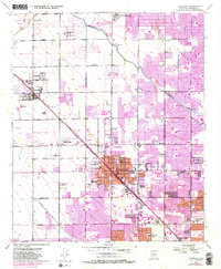
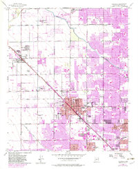
1957 Map of Glendale
USGS Topo · Published 1983About this map
The Glendale and Peoria agricultural corridor is captured here during a transition from desert farming to suburban expansion. The Atchison Topeka and Santa Fe railroad and the Arizona Canal form the backbone of the region, facilitating both transport and irrigation. Unique cultural landmarks include the Russian Molokan Cemetery south of Bethany Home Road, a physical remnant of the area's diverse religious history.
Find a feature on this map
69 named features on this map. Tap any name to fly to it.
Don’t see what you’re looking for? This feature index may not catch every label — zoom into the map to look around manually.
Map Details
Editions of this 1957 Glendale Map
6 editions found

Other maps of this area

1912 · Phoenix
USGS Topo · 1:62,500

1914 · Phoenix
USGS Topo · 1:62,500

1946 · Avondale
USGS Topo · 1:62,500

1948 · Cashion
USGS Topo · 1:62,500

1952 · Phoenix
USGS Topo · 1:24,000

1952 · Fowler
USGS Topo · 1:24,000

1952 · Phoenix
USGS Topo · 1:62,500

1954 · Phoenix
USGS Topo · 1:250,000

1957 · Phoenix
USGS Topo · 1:250,000

1957 · Calderwood Butte
USGS Topo · 1:24,000