
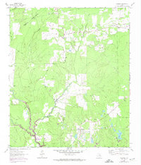
1962 Map of Glendale
USGS Topo · Published 1964About this map
The Houston Co Trinity Co boundary bisects this East Texas landscape, where the settlements of Glendale and Friday serve as the primary hubs for a rural community in the early 1960s. The terrain is defined by the winding course of White Rock Creek and its many tributaries, including Little White Rock Creek and Tantabague Creek. Evidence of earlier transport networks remains visible in the Old Railroad Grade that cuts through the southern portion of the quadrangle. Local genealogy is well-documented through several family-named landmarks and community centers, such as Holly Cem, Saron Cem, and Zion Hill Ch. Economic activity in the area is represented by scattered Oil Wells and a Gravel Pit near the headwaters of Sandy Creek, reflecting the region's reliance on natural resource extraction and small-scale agriculture.
Find a feature on this map
24 named features on this map. Tap any name to fly to it.
Don’t see what you’re looking for? This feature index may not catch every label — zoom into the map to look around manually.
Map Details
Editions of this 1962 Glendale Map
2 editions found
Other maps of this area

1953 · Palestine
USGS Topo · 1:250,000

1954 · Beaumont
USGS Topo · 1:250,000

1957 · Beaumont
USGS Topo · 1:250,000

1957 · Palestine
USGS Topo · 1:250,000

1960 · Trinity West
USGS Topo · 1:24,000

1960 · Trinity East
USGS Topo · 1:24,000

1962 · Lovelady South
USGS Topo · 1:24,000

1963 · Lovelady North
USGS Topo · 1:24,000

1963 · Groveton West
USGS Topo · 1:24,000
1963 · Pennington
USGS Topo · 1:24,000