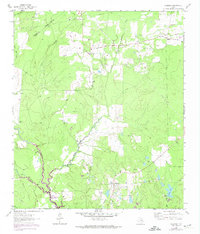
1962 Map of Glendale
USGS Topo · Published 1974About this map
The Houston Co Trinity Co line runs through this wooded landscape, marking a rural territory defined by creek drainages and small community centers. Glendale and Friday serve as the primary focal points of settlement, surrounded by several family-named burial grounds including Holly Cem, Anderson Cem, and Saron Cem. The 1970s updates to this map indicate significant changes to the southern terrain, specifically the controlled inundation areas of Lake Livingston Elevation 131 along the lower reaches of White Rock Creek and Tantabague Creek. Rural life in this era is anchored by local institutions like Zion Hill Ch and Thompson Sch, while the landscape is also marked by Oil Wells and Gravel Pits, pointing to the region's extraction activities. The meandering path of Little White Rock Creek and numerous pipelines further characterize the intersection of natural waterways and modern industrial infrastructure.
Find a feature on this map
25 named features on this map. Tap any name to fly to it.
Don’t see what you’re looking for? This feature index may not catch every label — zoom into the map to look around manually.
Map Details
Editions of this 1962 Glendale Map
2 editions found
Other maps of this area

1953 · Palestine
USGS Topo · 1:250,000

1954 · Beaumont
USGS Topo · 1:250,000

1957 · Beaumont
USGS Topo · 1:250,000

1957 · Palestine
USGS Topo · 1:250,000

1960 · Trinity West
USGS Topo · 1:24,000

1960 · Trinity East
USGS Topo · 1:24,000

1962 · Lovelady South
USGS Topo · 1:24,000

1962 · Glendale
USGS Topo · 1:24,000

1963 · Lovelady North
USGS Topo · 1:24,000

1963 · Groveton West
USGS Topo · 1:24,000