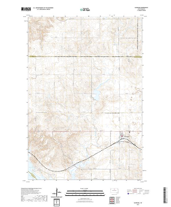
2021 Map of Glenham
USGS Topo · Published 2021About this map
Glenham serves as the central hub of this prairie landscape, situated near the western edge of Walworth County as the land slopes toward the Missouri river valley. The town's grid is anchored by Main St and Harrison St, with the Glenham Cem located just to the east along 128th St. The terrain is defined by the drainage systems of Cane Cr in the north and the meandering path of Blue Blanket Cr, which cuts across the central sections of the quadrangle. In the far southwest corner, the waters of Lake Oahe mark the modern extent of the Missouri River, reflecting the significant hydrological changes that have shaped this region of South Dakota. The surrounding township lines, including t124n r78w and t125n r78w, organize a vast network of section roads like 290th Ave and Orchard Rd that support the local agricultural economy.
Find a feature on this map
35 named features on this map. Tap any name to fly to it.
Don’t see what you’re looking for? This feature index may not catch every label — zoom into the map to look around manually.
Map Details
Editions of this 2021 Glenham Map
This is the sole edition of this map. No revisions or reprints were ever made.
Other maps of this area

1953 · McIntosh
USGS Topo · 1:250,000

1958 · McIntosh
USGS Topo · 1:250,000

1967 · Glenham
USGS Topo · 1:24,000

1967 · Selby SW
USGS Topo · 1:24,000

1967 · Mobridge NE
USGS Topo · 1:24,000

1967 · Mobridge NW
USGS Topo · 1:24,000

1967 · Mobridge
USGS Topo · 1:24,000

1967 · Selby NW
USGS Topo · 1:24,000

1968 · Moreau NW
USGS Topo · 1:24,000

1968 · Moreau NE
USGS Topo · 1:24,000