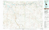
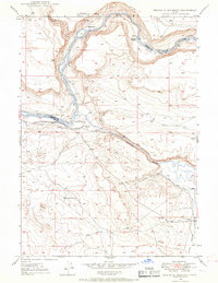
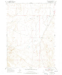
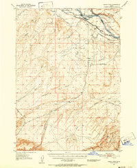
1992 Map of Glenns Ferry
USGS Topo · Published 1992About this map
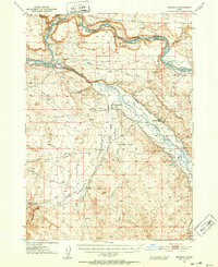
The Snake River carves a critical corridor through the high desert of southern Idaho, serving as the historical and industrial lifeline for settlements like Glenns Ferry and Hammett. This 1992 topographic study details the transition from the irrigated valley floors of the Pasadena Valley to the expansive arid reaches of the Bruneau Desert and the Blackstone Desert. The map highlights the intersection of pioneer history and modern utility, tracing the path of the Emigrant Trail alongside the Union Pacific railroad lines. To the south, the landscape is defined by the massive Saylor Creek Air Force Range and the dramatic geology of Bruneau Canyon. Water management is central to the region's character, evidenced by the sprawling C.J. Strike Reservoir and the network of drainages such as Little Canyon Creek and Sailor Creek that feed into the main river system.
Find a feature on this map
78 named features on this map. Tap any name to fly to it.
Don’t see what you’re looking for? This feature index may not catch every label — zoom into the map to look around manually.
Map Details
Editions of this 1992 Glenns Ferry Map
This is the sole edition of this map. No revisions or reprints were ever made.
Other maps of this area

1892 · Mountain Home
USGS Topo · 1:125,000

1892 · Bisuka
USGS Topo · 1:125,000

1892 · Camas Prairie
USGS Topo · 1:125,000

1893 · Mountain Home
USGS Topo · 1:125,000

1893 · Camas Prairie
USGS Topo · 1:125,000

1894 · Bisuka
USGS Topo · 1:125,000
1946 · Mouth of Bruneau
USGS Topo · 1:24,000
1947 · Little Valley
USGS Topo · 1:24,000
1947 · Grand View
USGS Topo · 1:62,500
1947 · Bruneau
USGS Topo · 1:62,500