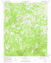
1970 Map of Glenola
USGS Topo · Published 1982About this map
The Norfolk Southern railway corridor anchors the northeastern corner of this landscape, connecting the small community of Glenola with the neighboring settlement of Edgar. This region of Randolph County is defined by its deep network of rural congregations and topographic prominence. Numerous historic houses of worship, including Marlboro Ch, Hopewell Ch, and Liberty Grove Ch, are interspersed throughout the countryside, often serving as the primary landmarks for local families. To the south, the terrain rises significantly toward Caraway Mtn and Shepherd Mtn, where Mt Shepherd Camp sits near a prominent radio tower. The drainage of the Uwharrie River and its tributaries, such as the Little Uwharrie River and Caraway Creek, further shapes the area. A notable Covered Bridge is located along the Little Uwharrie River, representing a surviving piece of traditional transportation infrastructure in a decade of gradual modernization.
Find a feature on this map
29 named features on this map. Tap any name to fly to it.
Don’t see what you’re looking for? This feature index may not catch every label — zoom into the map to look around manually.
Map Details
Editions of this 1970 Glenola Map
2 editions found
Other maps of this area

1949 · High Point West
USGS Topo · 1:24,000

1950 · High Point East
USGS Topo · 1:24,000

1951 · High Point East
USGS Topo · 1:24,000

1951 · Fair Grove
USGS Topo · 1:24,000

1953 · Raleigh
USGS Topo · 1:250,000

1953 · Charlotte
USGS Topo · 1:250,000

1954 · Charlotte
USGS Topo · 1:250,000

1954 · Raleigh
USGS Topo · 1:250,000

1957 · Denton
USGS Topo · 1:62,500

1957 · Asheboro
USGS Topo · 1:62,500