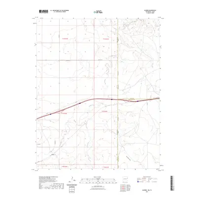
2023 Map of Glenrio
USGS Topo · Published 2023About this map
Endee sits at the western edge of the Llano Estacado, marking a site where local history and state boundaries converge. This modern survey illustrates the enduring footprint of ranching and early transportation in Quay County, where Rte 66 and State Hwy 93 cross the drainages of Trujillo Creek and Martha Creek. The terrain is characterized by broad draws like Sand Point Draw and the precise jurisdictional lines of the New Mexico-Texas border. For genealogists, the Endee Cem remains a primary landmark of the community's early settlement. The road network, including Quay Road 66 and Quay Road A, follows the section lines of the township and range system, reflecting the geometric organization of the High Plains landscape.
Find a feature on this map
23 named features on this map. Tap any name to fly to it.
Don’t see what you’re looking for? This feature index may not catch every label — zoom into the map to look around manually.
Map Details
Editions of this 2023 Glenrio Map
This is the sole edition of this map. No revisions or reprints were ever made.
Other maps of this area

1954 · Tucumcari
USGS Topo · 1:250,000

1958 · Tucumcari
USGS Topo · 1:250,000

1966 · Moser Ranch
USGS Topo · 1:24,000

1966 · Signal Spring
USGS Topo · 1:24,000

1966 · Sand Point
USGS Topo · 1:24,000

1968 · Rock Camp
USGS Topo · 1:24,000

1968 · Blue Hole
USGS Topo · 1:24,000

1968 · Riley Camp
USGS Topo · 1:24,000

1968 · Bard
USGS Topo · 1:24,000

1968 · Glenrio
USGS Topo · 1:24,000