
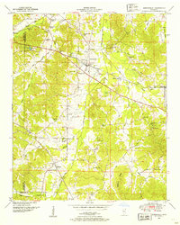
1935 Map of Glens
USGS Topo · Published 1935About this map
Southern Railway and Illinois Central tracks converge in the northeastern corner of Alcorn County, defining the early 20th-century transportation corridor through Glens. This 1935 survey captures a rural landscape where social life centered on small, dispersed congregations and local education. Notable sites include Cooks Chapel, Liberty Hill Ch, and the Zion Sch, all serving families settled along the ridge lines and creek valleys.
Find a feature on this map
22 named features on this map. Tap any name to fly to it.
Don’t see what you’re looking for? This feature index may not catch every label — zoom into the map to look around manually.
Map Details
Editions of this 1935 Glens Map
This is the sole edition of this map. No revisions or reprints were ever made.
Other maps of this area

1921 · Booneville
USGS Topo · 1:48,000

1922 · Booneville
USGS Topo · 1:62,500

1935 · Holcut
USGS Topo · 1:24,000

1935 · Doskie
USGS Topo · 1:24,000

1935 · Leedy
USGS Topo · 1:24,000

1936 · Kendrick
USGS Topo · 1:24,000

1950 · Corinth
USGS Topo · 1:62,500

1950 · Kendrick
USGS Topo · 1:24,000

1950 · Paden
USGS Topo · 1:24,000
1950 · Burnsville
USGS Topo · 1:24,000