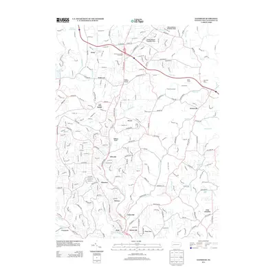
2013 Map of Glenshaw
USGS Topo · Published 2013About this map
Glenshaw and Allison Park serve as central points in this suburban landscape of northern Allegheny County, where the steep terrain of the Allegheny Plateau is deeply dissected by Pine Cr and its many tributaries. The map reveals a dense network of residential development and commercial corridors, notably along the William Flynn Hwy and Butler St. Industrial and transport legacies are evident near the southern boundary in Etna and Undereliff, where the valley narrows. Notable landmarks include the Pennsylvania Turnpike Interchange 4, which facilitates regional connectivity, and smaller aviation sites like Nardo Airport and Cedar Run Airport. The character of the area is further defined by its numerous small communities such as Elfinwild, Talley Cavey, and Dorseyville, each situated along the winding ridges and stream valleys that have historically dictated the region's growth.
Find a feature on this map
61 named features on this map. Tap any name to fly to it.
Don’t see what you’re looking for? This feature index may not catch every label — zoom into the map to look around manually.
Map Details
Editions of this 2013 Glenshaw Map
This is the sole edition of this map. No revisions or reprints were ever made.
Other maps of this area

1904 · Mc Keesport
USGS Topo · 1:62,500

1904 · Carnegie
USGS Topo · 1:62,500

1906 · Carnegie
USGS Topo · 1:62,500

1906 · Sewickley
USGS Topo · 1:62,500

1907 · Pittsburg
USGS Topo · 1:62,500

1908 · Sewickley
USGS Topo · 1:62,500

1908 · Carnegie
USGS Topo · 1:62,500

1908 · New Kensington
USGS Topo · 1:62,500

1910 · New Kensington
USGS Topo · 1:62,500

1948 · Pittsburgh West
USGS Topo · 1:24,000
Featured Places
- Ross Township, PA
- McCandless, PA
- Etna, PA
- Fawn Haven Number Two, Hampton Township
- Glenshaw, Shaler Township