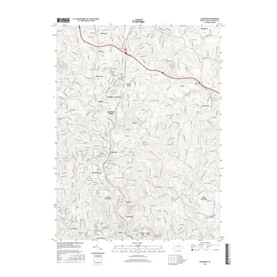
2016 Map of Glenshaw
USGS Topo · Published 2016About this map
Glenshaw and the surrounding townships north of Pittsburgh are defined by a complex web of stream-carved valleys and developed ridges. In this modern era, the landscape transitions from the dense urban fabric of Etna and Undercliff near the southern boundary to more suburban and rural character in Gibsonia and Bairdford to the north. Significant local heritage is preserved in the numerous religious and communal grounds throughout the region, including the Depreciation Lands Museum Cem and Mount Royal Cem.
Find a feature on this map
85 named features on this map. Tap any name to fly to it.
Don’t see what you’re looking for? This feature index may not catch every label — zoom into the map to look around manually.
Map Details
Editions of this 2016 Glenshaw Map
This is the sole edition of this map. No revisions or reprints were ever made.
Other maps of this area

1904 · Mc Keesport
USGS Topo · 1:62,500

1904 · Carnegie
USGS Topo · 1:62,500

1906 · Carnegie
USGS Topo · 1:62,500

1906 · Sewickley
USGS Topo · 1:62,500

1907 · Pittsburg
USGS Topo · 1:62,500

1908 · Sewickley
USGS Topo · 1:62,500

1908 · Carnegie
USGS Topo · 1:62,500

1908 · New Kensington
USGS Topo · 1:62,500

1910 · New Kensington
USGS Topo · 1:62,500

1948 · Pittsburgh West
USGS Topo · 1:24,000
Featured Places
- Ross Township, PA
- McCandless, PA
- Etna, PA
- Fawn Haven Number Two, Hampton Township
- Glenshaw, Shaler Township