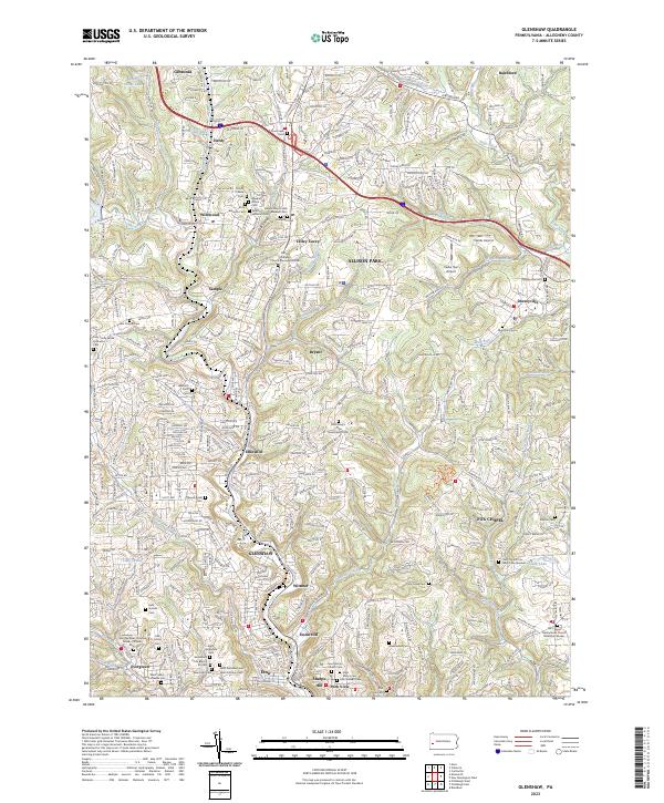
2023 Map of Glenshaw
USGS Topo · Published 2023About this map
Glenshaw and the surrounding Allegheny County communities are documented here as a complex network of residential developments and historic religious institutions. The map highlights a significant concentration of cultural sites in Wildwood, including the Depreciation Lands Museum and a cluster of Jewish cemeteries such as Torath Chaim Cem and Agudath Achim Cem. These landmarks reflect the deep immigrant and religious heritage that shaped the suburban landscape north of the Allegheny River.
Find a feature on this map
75 named features on this map. Tap any name to fly to it.
Don’t see what you’re looking for? This feature index may not catch every label — zoom into the map to look around manually.
Map Details
Editions of this 2023 Glenshaw Map
This is the sole edition of this map. No revisions or reprints were ever made.
Other maps of this area

1904 · Mc Keesport
USGS Topo · 1:62,500

1904 · Carnegie
USGS Topo · 1:62,500

1906 · Carnegie
USGS Topo · 1:62,500

1906 · Sewickley
USGS Topo · 1:62,500

1907 · Pittsburg
USGS Topo · 1:62,500

1908 · Sewickley
USGS Topo · 1:62,500

1908 · Carnegie
USGS Topo · 1:62,500
1908 · New Kensington
USGS Topo · 1:62,500
1910 · New Kensington
USGS Topo · 1:62,500
1948 · Pittsburgh West
USGS Topo · 1:24,000