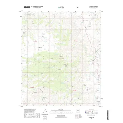
2020 Map of Glenwood
USGS Topo · Published 2020About this map
Glenwood and Pleasanton anchor the eastern edge of this rugged southwestern landscape, where the San Francisco River cuts through the high desert of the Gila National Forest. The topography is defined by a dense network of drainages and named summits, including Sierra Aguilada, Park Mtn, and Brushy Mtn. The reliance on water management in this arid environment is evident through dozens of named livestock tanks such as Petmaker Tank, Bill Tank, and Horse Shoe Tank scattered across the uplands.
Find a feature on this map
105 named features on this map. Tap any name to fly to it.
Don’t see what you’re looking for? This feature index may not catch every label — zoom into the map to look around manually.
Map Details
Editions of this 2020 Glenwood Map
This is the sole edition of this map. No revisions or reprints were ever made.
Other maps of this area

1910 · Mogollon
USGS Topo · 1:125,000

1912 · Mogollon
USGS Topo · 1:125,000

1913 · Morenci
USGS Topo · 1:125,000

1915 · Morenci
USGS Topo · 1:125,000

1954 · Clifton
USGS Topo · 1:250,000

1957 · Clifton
USGS Topo · 1:250,000

1958 · Clifton
USGS Topo · 1:250,000

1962 · Clifton
USGS Topo · 1:250,000

1962 · Big Lue Mts
USGS Topo · 1:62,500
1963 · Mogollon
USGS Topo · 1:24,000