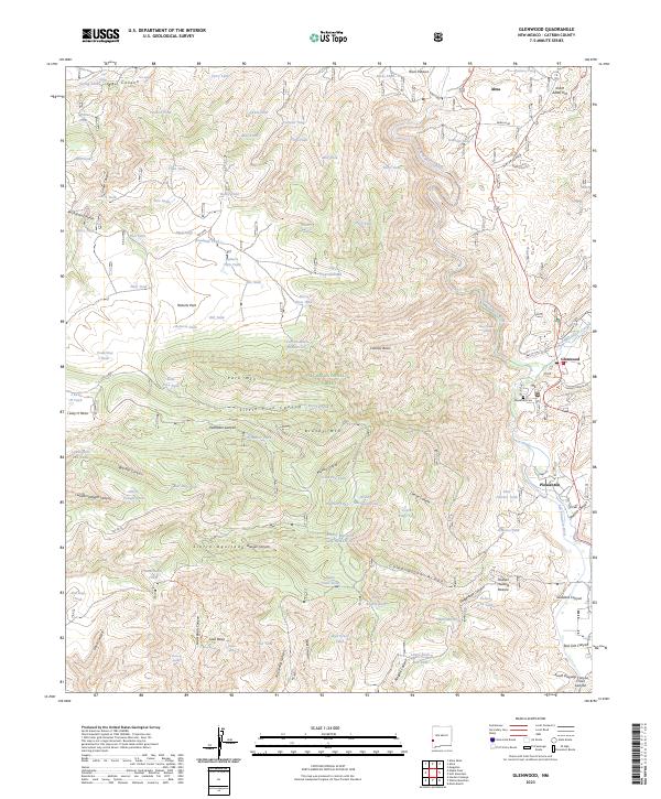
2023 Map of Glenwood
USGS Topo · Published 2023About this map
The San Francisco River corridor serves as the primary artery for settlement in this western New Mexico landscape, anchoring the communities of Alma, Glenwood, and Pleasanton. These small townships are bordered by the expansive Gila National Forest, where the terrain ascends into complex ridges and canyons such as Sierra Aguilada and Little Pine Canyon. A network of water management features, including Vigil Spring and numerous livestock tanks like Jerry Tank and Roadside Tank, highlights the ranching heritage of the high desert. Local family and place history is concentrated near the river valley, where the Glenwood Cem and the junction of Bursum Rd mark established routes into the surrounding backcountry. This survey details the transition from irrigated valley floors to the high elevations of Park Mtn and Brushy Mtn.
Find a feature on this map
98 named features on this map. Tap any name to fly to it.
Don’t see what you’re looking for? This feature index may not catch every label — zoom into the map to look around manually.
Map Details
Editions of this 2023 Glenwood Map
This is the sole edition of this map. No revisions or reprints were ever made.
Other maps of this area

1910 · Mogollon
USGS Topo · 1:125,000

1912 · Mogollon
USGS Topo · 1:125,000

1913 · Morenci
USGS Topo · 1:125,000

1915 · Morenci
USGS Topo · 1:125,000

1954 · Clifton
USGS Topo · 1:250,000

1957 · Clifton
USGS Topo · 1:250,000

1958 · Clifton
USGS Topo · 1:250,000

1962 · Clifton
USGS Topo · 1:250,000

1962 · Big Lue Mts
USGS Topo · 1:62,500
1963 · Mogollon
USGS Topo · 1:24,000