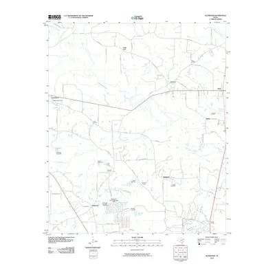
2010 Map of Glenwood
USGS Topo · Published 2010About this map
Little Cypress Creek and its many tributaries, including Rocky Branch, Clear Creek, and Glade Creek, define the drainage patterns of this Upshur County landscape. The region's mid-20th-century development is visible through several small settlements and a network of named rural roads, such as Cardinal Rd and Mockingbird Rd. Of particular interest to local historians are the numerous cemeteries that anchor the area's family histories, including Mattox Cemetery, Floyds Cemetery, and Bethlehem Cemetery. The presence of the New Diana Oil Field in the northeast and a high concentration of man-made lakes—evidenced by structures like Barton Lake Dam, McClellan Lake Dam, and Owens Lake Dam—points to a landscape significantly shaped by both the petroleum industry and local water management. The transition from older crossroads like Indian Rock and Graceton to the more structured layout of Glenwood Acres illustrates the shifting residential patterns of the early 21st century.
Find a feature on this map
78 named features on this map. Tap any name to fly to it.
Don’t see what you’re looking for? This feature index may not catch every label — zoom into the map to look around manually.
Map Details
Editions of this 2010 Glenwood Map
This is the sole edition of this map. No revisions or reprints were ever made.
Other maps of this area

1956 · Tyler
USGS Topo · 1:250,000

1960 · Bettie
USGS Topo · 1:24,000

1960 · White Oak
USGS Topo · 1:24,000

1960 · Gilmer
USGS Topo · 1:24,000

1960 · Coffeeville
USGS Topo · 1:24,000

1960 · Glenwood
USGS Topo · 1:24,000

1960 · Gladewater
USGS Topo · 1:24,000

1962 · Ashland
USGS Topo · 1:24,000

1962 · Longview Heights
USGS Topo · 1:24,000

1962 · Ore City
USGS Topo · 1:24,000