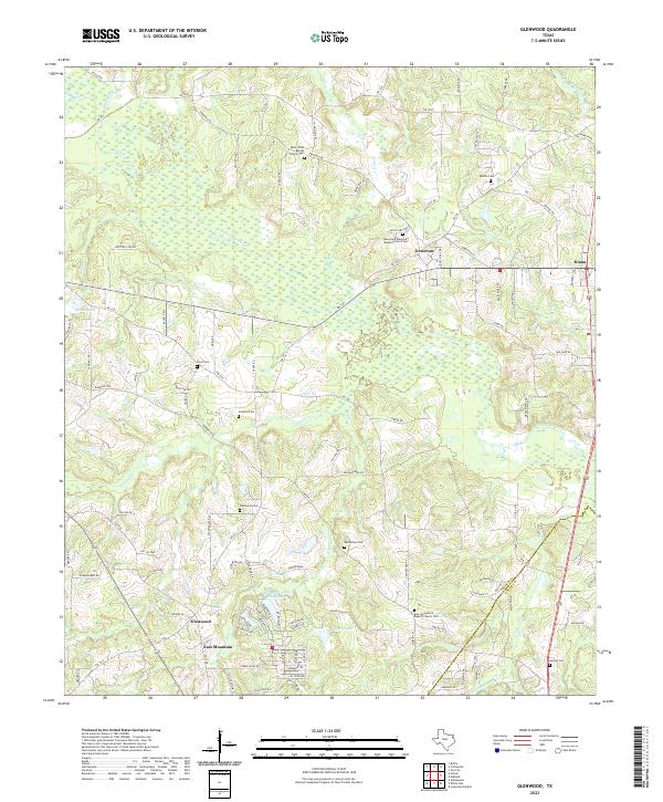
2022 Map of Glenwood
USGS Topo · Published 2022About this map
Upshur and Gregg counties meet in this modern landscape defined by the winding course of Little Cypress Cr and its many tributaries. The area is a dense network of small rural communities and family-named homesteads, characterized by the frequency of community burial grounds and churches such as Bethlehem Cem and East Springfield Baptist Church Cem. The terrain is marked by significant hydrological features including Brawley Lake and Barton Lake, reflecting the wet bottomlands of East Texas. A intricate web of Farm to Market roads, including FM 726 and FM 1650, connects the primary settlements of Glenwood, East Mountain, and Diana. This survey provides a contemporary perspective on a region that remains deeply tied to its historical cemetery locations, which serve as primary markers for genealogists and local historians tracing the evolution of these East Texas timberland communities.
Find a feature on this map
113 named features on this map. Tap any name to fly to it.
Don’t see what you’re looking for? This feature index may not catch every label — zoom into the map to look around manually.
Map Details
Editions of this 2022 Glenwood Map
This is the sole edition of this map. No revisions or reprints were ever made.
Other maps of this area

1956 · Tyler
USGS Topo · 1:250,000

1960 · Bettie
USGS Topo · 1:24,000

1960 · White Oak
USGS Topo · 1:24,000

1960 · Gilmer
USGS Topo · 1:24,000

1960 · Coffeeville
USGS Topo · 1:24,000

1960 · Glenwood
USGS Topo · 1:24,000

1960 · Gladewater
USGS Topo · 1:24,000

1962 · Ashland
USGS Topo · 1:24,000

1962 · Longview Heights
USGS Topo · 1:24,000

1962 · Ore City
USGS Topo · 1:24,000