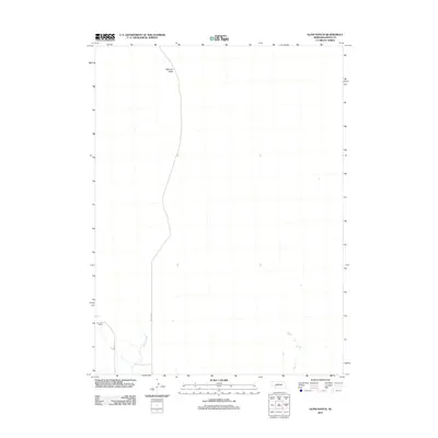
2011 Map of Glinn Ranch
USGS Topo · Published 2011About this map
Mannon Valley defines the northern reaches of this Keith County landscape, where the open terrain of the Nebraska sandhills meets early 21st-century ranching life. The area is characterized by vast, sparsely populated spaces typical of the High Plains, where water sources like Spring Creek dictate the placement of local infrastructure. To the southwest, the Draucker Ranch stands as a focal point of rural activity, connected to the wider region by a network of sectional roads including Road E F N and Road E G N. This survey provides a precise look at the land ownership patterns and water drainage systems of the western Nebraska ranching economy during this era.
Find a feature on this map
6 named features on this map. Tap any name to fly to it.
Don’t see what you’re looking for? This feature index may not catch every label — zoom into the map to look around manually.
Map Details
Editions of this 2011 Glinn Ranch Map
This is the sole edition of this map. No revisions or reprints were ever made.
Other maps of this area

1897 · Ogallala
USGS Topo · 1:125,000

1898 · Paxton
USGS Topo · 1:125,000

1900 · Ogallala
USGS Topo · 1:125,000

1901 · Paxton
USGS Topo · 1:125,000

1954 · North Platte
USGS Topo · 1:250,000

1956 · North Platte
USGS Topo · 1:250,000

1957 · North Platte
USGS Topo · 1:250,000

1967 · North Platte
USGS Topo · 1:250,000

1971 · Martin
USGS Topo · 1:24,000
1971 · Packard Ranch
USGS Topo · 1:24,000