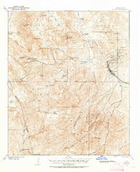
1901 Map of Globe
USGS Topo · Published 1955About this map
The silver and copper mining district surrounding Globe dominates this landscape at the dawn of the twentieth century. The map details a heavy industrial corridor along the G & N R R, where major operations like the Old Dominion Mine, Buffalo Mine, and Grey Mine established the region's economic foundation. Beyond the immediate bustle of the town and its adjacent Miami Flat, the terrain transitions into the high country of the Pinal Mountains and the Tonto National Forest. Numerous family outposts such as Schultze Ranch and Murphy Ranch are scattered through the gulches, while the southern reaches are defined by landmarks like Pinal Peak and the deep Icehouse Canyon. This survey captures the critical early development phase of the Gila County mineral belt, showing the intricate network of mines including the Keystone Mine and Continental Mine before later large-scale open-pit operations altered the topography.
Find a feature on this map
57 named features on this map. Tap any name to fly to it.
Don’t see what you’re looking for? This feature index may not catch every label — zoom into the map to look around manually.
Map Details
Editions of this 1901 Globe Map
2 editions found
Other maps of this area

1900 · Florence
USGS Topo · 1:125,000

1901 · Globe
USGS Topo · 1:62,500

1902 · Globe
USGS Topo · 1:62,500

1902 · Florence
USGS Topo · 1:125,000

1907 · Roosevelt
USGS Topo · 1:125,000

1909 · Four Peaks
USGS Topo · 1:125,000

1910 · Ray
USGS Topo · 1:62,500

1912 · Roosevelt
USGS Topo · 1:125,000

1915 · Christmas
USGS Topo · 1:62,500

1917 · Christmas
USGS Topo · 1:62,500